The conditions along the inland waterway system remain concerning. The metaphor I routinely use – “Attaching a garden hose to a fire hydrant” – continues to be applicable. Farmers are continuing to harvest an overall strong crop, but the inland waterway system – especially the lower Mississippi River – does not currently possess the normal capacity to accommodate it. This is particularly a challenge for the soybean industry given how the September through February time period accounts for 80% of U.S. soybean exports and more than half of soybeans produced in the country are exported.
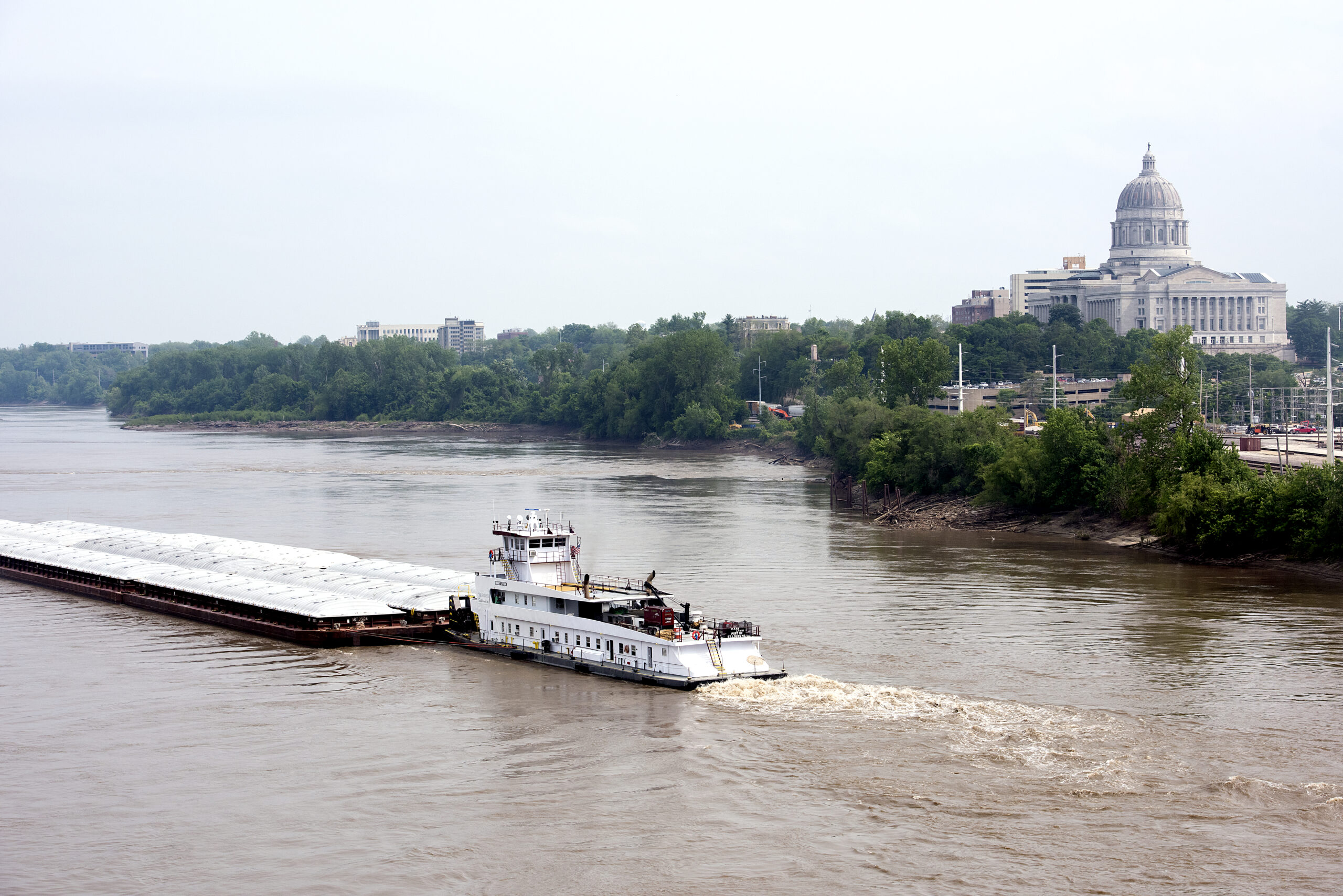
Barge transportation is essential for connecting U.S. soybean farmers with international customers.
We continue to see the low water conditions result in limits on channel depth and channel width. In its “American Currents” newsletter, American Commercial Barge Lines highlights how depth restrictions of no greater than 9 ft. have been instituted on the Lower Mississippi River (a 24-30%) decrease. Barges are often loaded to 11 ft. to 12 ft. at this time of the year on the Mississippi River south of St. Louis. For every one foot of decreased water depth, 5,000 fewer bushels of soybeans are loaded into each barge. Therefore, a 2-3 three foot reduction will result in 10,000 to 15,000 fewer bushels. Barges on the lower Mississippi River are often loaded with 57,000 bushels and upper Mississippi River barges will be loaded with 50,000 to 52,000 bushels due to the minimum 9 ft. navigation channel. The barge industry continues to maintain a maximum of 25 barges connected together along the Lower Mississippi River compared to 30, 35 or even 40 barges under normal conditions.
According to the U.S. Department of Agriculture’s most recent “Grain Transportation Report”, barge freight rates have fallen. For the week of October 18, transporting a ton of soybeans – loaded in St. Louis – cost $72.58 per ton. For the week of October 11, it cost $105.85. The $72.58 cost is still 130% higher than the same week in 2021. If barge rates have declined so significantly from the earlier week, does this mean the situation is improving? I wish that was the case.
Amid uncertainty about when barge traffic will normalize, some grain shippers have delayed deliveries until later in the year, which has softened demand for barges. Many farmers are deciding to pursue alternatives that are available to them – whether storage, delivering to a rail loading facility, delivering to a soybean processor, etc. It’s kind of similar to being at Disney World and noticing a two hour wait for Space Mountain. Later in the day, the visitor notices the wait is down to 90 minutes. Has the situation at Space Mountain improved? Not necessarily. In reality, many visitors simply abandoned their plans to ride Space Mountain, concluding, “It’s not worth it. I’ll have to wait to ride it the next time I visit.”
The chart from the U.S. Geological Survey shows the river gage levels on the Mississippi River at Memphis. As you can see, the river gage was at -9.33 ft. A year ago, the gage was at 1.46 ft. – almost 11 ft. higher than the current reading. On October 22nd, 2022, the gage was at -10.81 ft. so we have seen a foot and a half increase in water depth over the past 4 days, which is certainly welcome. However, water levels are still significantly low and continue to impede barge transportation. Here are some additional statistics for Memphis to provide some perspective:
- Highest gage reading in 2022: 30.71 ft. (March 9th, 2022)
- Action stage (the stage at which a rising water level will begin to trigger mitigation measures by the authority in charge): 28 ft.
- Minor flood stage: 34 ft.
- Major flood stage: 46 ft.
- Minimum operating limit: -12 ft.
What is interesting about the chart is how the yellow line (gage readings in 2022) and the gray line (gage readings from 2021) relatively tracked each other throughout much of year. However, notice in September how the yellow line continues to drop due to scarce rainfall while the gray line fluctuated but maintained a consistently higher level. The lack of rainfall in late summer/early fall this year has clearly had a negative impact.
Here are additional gage readings at a variety of other locations:
St. Louis
- October 25, 2022: -0.11 ft.
- October 25, 2021: 8.24 ft.
- Lowest level over the past seven days: -3.07 ft. (October 24, 2022)
- Highest gage reading in 2022: 29.61 ft. (May 7, 2022)
- Action stage (the stage at which a rising water level will begin to trigger mitigation measures by the authority in charge): 28 ft.
- Minor flood stage: 35 ft.
- Major flood stage: 40 ft.
- Minimum operating limit: -4.97 ft.
Baton Rouge
- October 25, 2022: 4.63 ft.
- October 25, 2021: 9.95 ft.
- Lowest level over the past seven days: 4.04 ft. (October 21, 2022)
- Highest gage reading in 2022: 35.76 ft. (March 24, 2022)
- Action stage (the stage at which a rising water level will begin to trigger mitigation measures by the authority in charge): N/A
- Minor flood stage: N/A
- Major flood stage: N/A
- Minimum operating limit: N/A
Louisville
- October 25, 2022: 13.11 ft.
- October 25, 2021: 12.92 ft.
- Lowest level over the past seven days: 12.35 ft. (October 22, 2022)
- Highest gage reading in 2022: 23.11 ft. (March 1, 2022)
- Action stage (the stage at which a rising water level will begin to trigger mitigation measures by the authority in charge): N/A
- Minor flood stage: N/A
- Major flood stage: N/A
- Minimum operating limit: N/A
Davenport
- October 25, 2022: 3.9 ft.
- October 25, 2021: 4.18 ft.
- Lowest level over the past seven days: 3.27 ft. (October 18, 2022)
- Highest gage reading in 2022: 7.62 ft. (September 3, 2022)
- Action stage (the stage at which a rising water level will begin to trigger mitigation measures by the authority in charge): 11 ft.
- Minor flood stage: 12 ft.
- Major flood stage: N/A
- Minimum operating limit: 2 ft.
St. Paul
- October 25, 2022: 3.35 ft.
- October 25, 2021: 3.27 ft.
- Lowest level over the past seven days: 3.15 ft. (October 22, 2022)
- Highest gage reading in 2022: 13.25 ft. (May 22, 2022)
- Action stage (the stage at which a rising water level will begin to trigger mitigation measures by the authority in charge): 10 ft.
- Minor flood stage: 14 ft.
- Major flood stage: 17 ft.
- Minimum operating limit: 2 ft.
The water levels in the upper Mississippi River, Ohio River, Illinois River and others clearly benefit from the system of locks and dams that serve to restrain water in order to maintain water levels so that navigation can continue. That being said, we are still witnessing historical shallow areas throughout the lock and dam portion of the overall system. The Mississippi River south of St. Louis does not have locks and dams since, under normal conditions, water depth and width are sufficient to maintain robust navigation on its own.
Those farmers located in areas of the country in which alternatives are available are clearly better positioned to withstand these challenges. Given the challenges facing barge transportation, many farmers are exploring options B, C and D. Other options may include driving a longer distance to a soybean processor or a facility with rail loading capacity. However, some farmers – especially many close to the river system – have limited or no on-farm storage. In many areas, the inland waterway system under normal conditions is such an attractive avenue for soybeans and grain that alternatives have not developed since they would be at a competitive disadvantage to the normal efficiencies of barge transportation. The farmers who are in this situation – with limited on-farm storage and alternative delivery options – will be the most exposed to the current challenges facing the inland waterway system.
There is also a pending rail strike. An actual rail strike will clearly halt economic activity, but the threat of a rail strike can achieve this as well. For industries like agriculture, the decisions made today are determining where and how soybeans and grain will be shipped next month, two months from now.
Having a predictable supply chain is essential for agriculture to succeed, but this predictability is clearly impugned during the middle of harvest season.